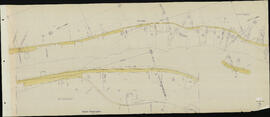
Great Northern Blueprint Number 1622-23-1, map of Exhibit "B" Railroad Relocation for Rocky Reach Dam, 1967. Other subject categories: Right of Way and Track Map
Great Northern Blueprint Number 1622-28-6, map of Exhibit "A" Deed Print for Rocky Reach Dam, 1967. Other subject categories: Right of Way and Track Map
Great Northern Blueprint Number 1622-26-1, map of Exhibit "B" Railroad Relocation for Rocky Reach Dam, 1967. Other subject categories: Right of Way and Track Map
Great Northern Blueprint Number 1622-28-3, map of Exhibit "A" Deed Print for Rocky Reach Dam, 1967. Other subject categories: Right of Way and Track Map
Great Northern Blueprint Number 1622-28-5, map of Exhibit "A" Deed Print for Rocky Reach Dam, 1967. Other subject categories: Right of Way and Track Map
AFE 62.0489, Rocky Reach, Washington, 1962. Interstate Commerce Commission Account Number 14, Crossings. Series II. Lines West. Other Subject Categories: Crossings, Public
Great Northern Plat Map, Rocky Reach, Washington. Milepost Relocate Line Near Rocky Reach. Milepost 6-9, Great Northern Washington Volume 6 Map 02, undated.
AFE, Series II, Number 62.489, Rocky Reach, Washington, May 18, 1962, Easement and Changes for Highway. Located in folder 'Olds'. Other subject categories: Property. Initial cataloger's disposition code: X, AFE itself not found but referenced in other documents