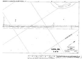
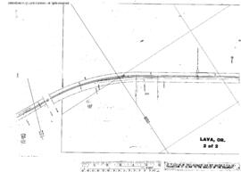
Plat Map of Great Northern facilities at Lava, Oregon, March 1, 1932, Sheet Number 2, Line Segment 54, showing the Bend-Chemult line.
Plat Map of Great Northern facilities at Lava, Oregon, March 1, 1932, Sheet Number 1, Line Segment 54, showing the Bend-Chemult line.
Great Northern Blueprint Number 1215-36, map of Lava to Sherlin - Hixon Junction, Showing Right of Way to Be Aquired from Shrlin-Hixon Company, 1932. Other subject categories: Right of Way and Track Map
Great Northern Blueprint Number 1176-3-3 , map of Lava, 1928. Other subject categories: Right of Way and Track Map
AFE 77392, Lava, Oregon, 1948. Construct 11,420 Linal Feet of Right of Way Fence Along Land of Mayfield and Franks. Interstate Commerce Commission Account Number 13, Fences, Snowsheds and Signs. Cost: $1850. Series A. Lines West. Other Subject Categories: Fences, Right of Way
AFE 66.051, Lava, Oregon, 1966. Extend Track 4100'. Interstate Commerce Commission Account Number 12, Track Laying and Surfacing. Series II. Lines West. Other Subject Categories: Track, Industry
AFE 37633, Lava And Silver Lake, Oregon, 1928. Construct Three Private Road Crossings for United States Forest Service. Interstate Commerce Commission Account Number 14, Crossings. Cost: $120. Series II. Lines West. Klamath Division.
AFE, Series II, Number 62688, Lava, Oregon, October 27, 1941, Extend Passing Track. Located in folder 'Lava'. Other subject categories: Track. Initial cataloger's disposition code: M, AFE Sheet page 1, with map or other paper
AFE, Series II, Number 37633, Lava, Oregon, August 21, 1928, 3 Crossings for Forest Service. Located in folder 'Lava'. Other subject categories: Crossings. Initial cataloger's disposition code: Z, File not retained