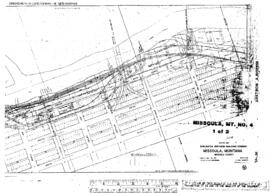
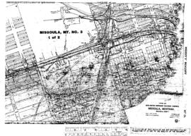
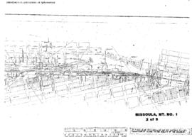
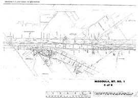
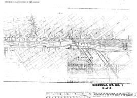
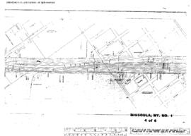
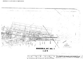
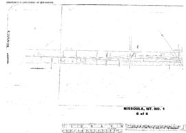
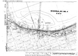
Plat Map of Milwaukee Road facilities at Missoula, Montana, September 27, 1923, Drawing Number 31198, Sheet Number 2, showing the Milwaukee Road mainline.
Plat Map of Milwaukee Road facilities at Missoula, Montana, September 27, 1923, Drawing Number 31198, Sheet Number 1, showing the Milwaukee Road mainline.
Plat Map of Northern Pacific facilities at Missoula, Montana, September 23, 1915, Sheet Number 2, Line Segment 716, showing the Dakota Street spur.
Plat Map of Northern Pacific facilities at Missoula, Montana, September 23, 1915, Sheet Number 1, Line Segment 716, showing the Missoula yard, industry spurs.
Plat Map of Northern Pacific facilities at Missoula, Montana, November 11, 1969, Sheet Number 2, Line Segment 716, showing the Missoula yard, depot, roundhouse.
Plat Map of Northern Pacific facilities at Missoula, Montana, November 11, 1969, Sheet Number 5, Line Segment 716, showing the Missoula yard.
Plat Map of Northern Pacific facilities at Missoula, Montana, November 11, 1969, Sheet Number 3, Line Segment 716, showing the Missoula yard, industry spurs.
Plat Map of Northern Pacific facilities at Missoula, Montana, November 11, 1969, Sheet Number 4, Line Segment 716, showing the Missoula yard.
Plat Map of Northern Pacific facilities at Missoula, Montana, November 11, 1969, Sheet Number 1, Line Segment 716, showing the Missoula yard, east end.
Plat Map of Northern Pacific facilities at Missoula, Montana, November 11, 1969, Sheet Number 6, Line Segment 716, showing the Missoula yard, west end.