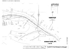
Plat Map of Northern Pacific facilities at Homestake, Montana, May 1, 1957, Sheet Number 1, Line Segment 326, showing the Logan-Butte line.
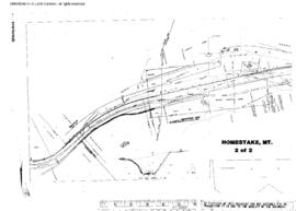
Plat Map of Northern Pacific facilities at Homestake, Montana, May 1, 1957, Sheet Number 2, Line Segment 326, showing the Logan-Butte line.
Plat Map of Northern Pacific facilities at Holtzinger, Washington, December 2, 1931, Sheet Number 2, Line Segment 445, showing the Brace-Tieton line.
Plat Map of Northern Pacific facilities at Holtzinger, Washington, December 2, 1931, Sheet Number 1, Line Segment 445, showing the Brace-Tieton line.
Plat Map of Northern Pacific facilities at Holmes, Washington, May 19, 1945, Sheet Number 1, Line Segment 48, showing the Pasco-Ellensburg line.
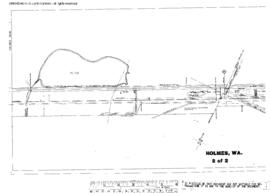
Plat Map of Northern Pacific facilities at Holmes, Washington, May 19, 1945, Sheet Number 2, Line Segment 48, showing the Pasco-Ellensburg line.
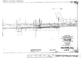
Plat Map of Northern Pacific facilities at Holcomb, Washington, September 6, 1916, Sheet Number 1, Line Segment 420, showing the Chehalis-South Bend line.
Plat Map of Northern Pacific facilities at Holcomb, Washington, September 6, 1916, Sheet Number 2, Line Segment 420, showing the Chehalis-South Bend line.
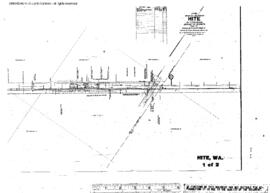
Plat Map of Northern Pacific facilities at Hite, Washington, September 3, 1913, Sheet Number 1, Line Segment 378, showing the Cheney-Coulee City line.
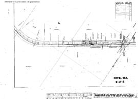
Plat Map of Northern Pacific facilities at Hite, Washington, September 3, 1913, Sheet Number 2, Line Segment 378, showing the Cheney-Coulee City line.
Plat Map of Northern Pacific facilities at Hillhurst, Washington, May 12, 1892, Sheet Number 1, Line Segment 400, showing the 11th Street (Union Pacific Junction, Tacoma)-Tenino Junction line.
Plat Map of Northern Pacific facilities at Hesper, Montana, December 8, 1919, Sheet Number 1, Line Segment 363, showing the Hesper-Rapelje line.
Plat Map of Northern Pacific facilities at Hesper, Montana, December 8, 1919, Sheet Number 2, Line Segment 363, showing the Hesper-Rapelje line.
Plat Map of Northern Pacific facilities at Heron, Montana, June 16, 1931, Sheet Number 2, Line Segment 44, showing the Paradise-Kootenai line.
Plat Map of Northern Pacific facilities at Heron, Montana, June 16, 1931, Sheet Number 3, Line Segment 44, showing the Paradise-Kootenai line.
Plat Map of Northern Pacific facilities at Heron, Montana, June 16, 1931, Sheet Number 1, Line Segment 44, showing the Paradise-Kootenai line.
Plat Map of Northern Pacific facilities at Helena, Montana, August 1, 1933, Sheet Number 1, Line Segment 713, showing the Helena yard, fairgrounds.
Plat Map of Northern Pacific facilities at Helena, Montana, August 1, 1933, Sheet Number 2, Line Segment 713, showing the Helena yard, fairgrounds.
Plat Map of Northern Pacific facilities at Helena, Montana, September 30, 1931, Sheet Number 1, Line Segment 713, showing the Northern Pacific yard, Great Northern mainline.
Plat Map of Northern Pacific facilities at Helena, Montana, September 30, 1931, Sheet Number 2, Line Segment 713, showing the Northern Pacific yard, industry spurs, Great Northern mainline.
Plat Map of Northern Pacific facilities at Helena, Montana, September 30, 1931, Sheet Number 3, Line Segment 713, showing the Northern Pacific yard, spurs, depot.
Plat Map of Northern Pacific facilities at Helena, Montana, September 30, 1931, Sheet Number 3, Line Segment 713, showing the Northern Pacific mainline, industry spurs.
Plat Map of Northern Pacific facilities at Helena, Montana, June 14, 1917, Sheet Number 4, Line Segment 713, showing the Northern Pacific mainline, Rimini branch.
Plat Map of Northern Pacific facilities at Helena, Montana, June 14, 1917, Sheet Number 4, Line Segment 713, showing the Northern Pacific mainline, Great Northern interchange.
Plat Map of Northern Pacific facilities at Helena, Montana, June 14, 1917, Sheet Number 2, Line Segment 713, showing the Northern Pacific mainline, Great Northern interchange.
Plat Map of Northern Pacific facilities at Helena, Montana, June 14, 1917, Sheet Number 1, Line Segment 713, showing the Northern Pacific mainline, Great Northern interchange.
Plat Map of Northern Pacific facilities at Hazel, Washington, June 21, 1909, Sheet Number 2, Line Segment 406, showing the Darrington-Kruse Junction line.
Plat Map of Northern Pacific facilities at Hazel, Washington, June 21, 1909, Sheet Number 1, Line Segment 406, showing the Darrington-Kruse Junction line.
Plat Map of Northern Pacific facilities at Hauser, Idaho, May 20, 1931, Sheet Number 2, Line Segment 45, showing the Kootenai-Spokane line.
Plat Map of Northern Pacific facilities at Hauser, Idaho, May 20, 1931, Sheet Number 3, Line Segment 45, showing the Kootenai-Spokane line.