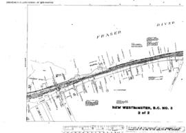
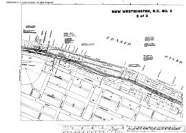
Plat Map of Great Northern facilities at New Westminster, British Columbia, March 1, 1915, Sheet Number 2, Line Segment 56, 602, showing the Vancouver-White Rock line, Vancouver Power spur.
Plat Map of Great Northern facilities at New Westminster, British Columbia, September 1, 1915, Sheet Number 2, Line Segment 56, 602, showing the Vancouver-White Rock line, Fraser River drawbridge east end.
Plat Map of Great Northern facilities at New Westminster, British Columbia, March 1, 1915, Sheet Number 1, Line Segment 56, 602, showing the Vancouver-White Rock line, Vancouver Power spur.
Plat Map of Great Northern facilities at New Westminster, British Columbia, January 1, 1936, Sheet Number 1, Line Segment 602, showing the Riverside, lumber spurs.
Plat Map of Great Northern facilities at New Westminster, British Columbia, January 1, 1936, Sheet Number 2, Line Segment 602, showing the Riverside, lumber spurs.
Plat Map of Great Northern facilities at New Westminster, British Columbia, August 1, 1946, Sheet Number 2, Line Segment 56, 602, showing the Vancouver-White Rock line, Brunette Street, depot, Coquitlam Junction.
Plat Map of Great Northern facilities at New Westminster, British Columbia, August 1, 1946, Sheet Number 1, Line Segment 56, 602, showing the Vancouver-White Rock line,ÿBrunette Street, depot, industry spurs.
Plat Map of Great Northern facilities at New Westminster, British Columbia, October 1, 1963, Sheet Number 2, Line Segment 56, 602, showing the Vancouver-White Rock line, riverside, penitentiary.
Plat Map of Great Northern facilities at New Westminster, British Columbia, October 1, 1963, Sheet Number 1, Line Segment 56, 602, showing the Vancouver-White Rock line, Front Street.
Plat Map of Great Northern facilities at New Westminster, British Columbia, October 1, 1963, Sheet Number 2, Line Segment 56, 602, showing the Vancouver-White Rock line, Front Street.
Plat Map of Great Northern facilities at New Westminster, British Columbia, October 1, 1963, Sheet Number 1, Line Segment 56, 602, showing the Vancouver-White Rock line, Front Street, Fraser bridge west end.
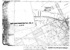
Plat Map of Great Northern facilities at New Westminster, British Columbia, May 1, 1964, Sheet Number 2, Line Segment 602, showing the New Westminster yard, Brownsville, Delta Alaska terminal.
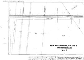
Plat Map of Great Northern facilities at New Westminster, British Columbia, May 1, 1964, Sheet Number 3, Line Segment 56, 602, showing the Vancouver-White Rock line, Brownsville, Robson Road.
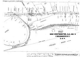
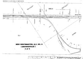
Plat Map of Great Northern facilities at New Westminster, British Columbia, May 1, 1964, Sheet Number 4, Line Segment 56, 602, showing the Vancouver-White Rock line, Brownsville, Delta Alaska spur, Canadian National interchange.
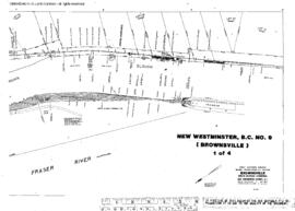
Plat Map of Great Northern facilities at New Westminster, British Columbia, May 1, 1964, Sheet Number 1, Line Segment 56, 602, showing the Vancouver-White Rock line, Brownsville, Delta Alaska terminal.
Plat Map of Great Northern facilities at New Westminster, British Columbia, undated, Sheet Number 1, Line Segment 602, showing the Sapperton gravel, Coquitlam.
Plat Map of Great Northern facilities at New Westminster, British Columbia, undated, Sheet Number 2, Line Segment 602, showing the Sapperton gravel, Coquitlam.
Plat Map of Great Northern facilities at Newport, Washington, January 3, 1944, Drawing Number 8012-3, Sheet Number 1, Line Segment 37, showing the Sandpoint Junction-Everett Junction line.
Plat Map of Great Northern facilities at Newport, Washington, January 3, 1944, Drawing Number 8012-3, Sheet Number 2, Line Segment 37, showing the Sandpoint Junction-Everett Junction line.
Plat Map of Great Northern facilities at Newport, Washington, March 1, 1960, Sheet Number 1, Line Segment 37, showing the Sandpoint Junction-Everett Junction line.
Plat Map of Great Northern facilities at Newport, Washington, March 1, 1960, Sheet Number 3, Line Segment 37, showing the Sandpoint Junction-Everett Junction line.
Plat Map of Great Northern facilities at Newport, Washington, March 1, 1960, Sheet Number 2, Line Segment 37, showing the Sandpoint Junction-Everett Junction line, Milwaukee Road interchange.
Plat Map of Great Northern facilities at Nighthawk, Washington, undated, Sheet Number 3, Line Segment 390, showing the Chopaka-Oroville (Curlew-Keremeos) line.
Plat Map of Great Northern facilities at Nighthawk, Washington, undated, Sheet Number 2, Line Segment 390, showing the Chopaka-Oroville (Curlew-Keremeos) line.
Plat Map of Great Northern facilities at Nighthawk, Washington, undated, Sheet Number 1, Line Segment 390, showing the Chopaka-Oroville (Curlew-Keremeos) line.
Plat Map of Great Northern facilities at Nimrod/Java, Montana, December 8, 1911, Drawing Number 01548-1, Sheet Number 1, Line Segment 36, showing the Pacific Junction-Sandpoint Junction line.
Plat Map of Great Northern facilities at Nimrod/Java, Montana, December 8, 1911, Drawing Number 01548-1, Sheet Number 2, Line Segment 36, showing the Pacific Junction-Sandpoint Junction line.
Plat Map of Great Northern facilities at North Fork, Montana, September 1, 1930, Sheet Number 1, Line Segment 35, showing the Minot-Pacific Junction line.
Plat Map of Great Northern facilities at North Fork, Montana, September 1, 1930, Sheet Number 2, Line Segment 35, showing the Minot-Pacific Junction line.
Plat Map of Great Northern facilities at Northport, Washington, October 1, 1939, Sheet Number 1, Line Segment 376, showing the Boundary-Dean-Kettle Falls line.