Great Northern Blueprint Number 1241-10-2, letter regarding Vancouver, Westminster & Yukon Railway Crossing with Canadian Pacific Railway, approval from Commission, 1906. Other subject categories: Letter
We've redirected you to the first page of results. To avoid using vast amounts of memory, AtoM limits pagination to 10000 records. To view the last records in the current result set, try changing the sort direction.
Great Northern Blueprint Number 1241-10-2, letter regarding Vancouver, Westminster & Yukon Railway Crossing with Canadian Pacific Railway, approval from Commission, 1906. Other subject categories: Letter
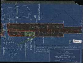
Great Northern Blueprint Number 1241-10-1, map of Vancouver, Westminster & Yukon Railway Crossing with Canadian Pacific Railway (2 copies), 1906. Other subject categories: Filing Map
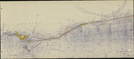
Great Northern Blueprint Number 1235-11-11, map of Station Grounds at Abbotsford, 1908. Other subject categories: Right of Way and Track Map
Great Northern Blueprint Number 1037-33-1, map of Vancouver, Victoria and Eastern Railway Amended Location in Yale District, 1905. Other subject categories: Filing Map
Great Northern Blueprint Number 1253-26-1, map of Water Supply at Section 14 to 66, undated. Other subject categories: Filing Map
Great Northern Blueprint Number 1039-32-1, map of Amended Filing near Phoenix, 1903. Other subject categories: Filing Map
Great Northern Blueprint Number 1039-32-4, map of Amended Plan and Profile near Phoenix, 1903. Other subject categories: Filing Map
Great Northern Blueprint Number 1615-7, map of Galbraith Tram Under Crossing near Lincoln, undated. Other subject categories: Filing Map
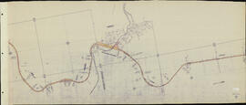
Great Northern Blueprint Number 1615-18-3, map of Right of Way Trough Hope (3 copies), 1920. Other subject categories: Filing Map
Great Northern Blueprint Number 1615-17-2, map of Hope Terminals, 1916. Other subject categories: Filing Map
Great Northern Blueprint Number 1615-17-3, map of Hope Terminals, 1916. Other subject categories: Filing Map
Great Northern Blueprint Number 1615-10-5, map of Division Yard at Hope, 1915. Other subject categories: Filing Map
Great Northern Blueprint Number 1615-10-4, map of Division Yard at Hope, 1914. Other subject categories: Filing Map
Great Northern Blueprint Number 1009-4-4, Yale District Vicinity of Phoenix, 1903. Other subject categories: Book Reference
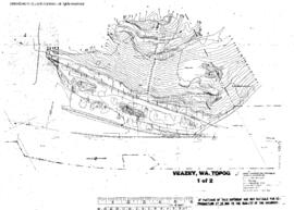
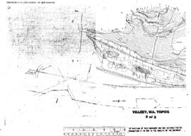
Plat Map of Northern Pacific facilities at Veazey, Washington, January 22, 1980, Sheet Number Topographical map., Line Segment 411, showing the Palmer Junction-Meeker line.
Spokane, Coeur d'Alene and Palouse Railroad Plat Map, Treat to Mount Hope, Washington, Milepost 23-27, Spokane, Coeur d'Alene and Palouse Washington Volume 2 Map 07, undated.
Spokane, Coeur d'Alene and Palouse Railroad Plat Map, Spokane, Washington, Orchard Avenue, Spokane, Coeur d'Alene and Palouse Washington Volume 1 Map 02b, undated.
Spokane, Coeur d'Alene and Palouse Railroad Plat Map, Spokane, Washington, Milepost 1-5, Spokane, Coeur d'Alene and Palouse Washington Volume 1 Map 01, 1923.
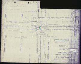
Spokane, Coeur d'Alene and Palouse Railroad Plat Map, Millwood, Washington, Millwood Easement, Spokane, Coeur d'Alene and Palouse Washington Volume 1 Map 02a, undated.
Spokane, Coeur d'Alene and Palouse Railroad Plat Map, Del Monte, Washington, Del Monte, Spokane, Coeur d'Alene and Palouse Washington Volume 1 Map 02, undated.
Spokane, Coeur d'Alene and Palouse Railroad Plat Map, West Fairfield, Washington, West Fairfield, Spokane, Coeur d'Alene and Palouse Washington Volume 2 Map 08a, 1906.
Spokane, Coeur d'Alene and Palouse Railroad Plat Map, West Fairfield to Lenox to Rattlers Run to Loke, Washington, Milepost 28-31, Spokane, Coeur d'Alene and Palouse Washington Volume 2 Map 08, undated.
Spokane, Coeur d'Alene and Palouse Railroad Plat Map, West Fairfield to Fairfield, Washington, West Fairfield to Fairfield connection, Spokane, Coeur d'Alene and Palouse Washington Volume 2 Map 08, undated.
Spokane, Coeur d'Alene and Palouse Railroad Plat Map, Waverly, Washington, Milepost 34, Spokane, Coeur d'Alene and Palouse Washington Volume 2 Map 09a, undated.
Spokane, Coeur d'Alene and Palouse Railroad Plat Map, Waverly to Jefferson, Washington, Milepost 32-37, Spokane, Coeur d'Alene and Palouse Washington Volume 2 Map 09, undated.
Spokane, Coeur d'Alene and Palouse Railroad Plat Map, Tolido to Liberty Lake, Washington,, Spokane, Coeur d'Alene and Palouse Washington Volume 1 Map 07, 1928.
Spokane, Coeur d'Alene and Palouse Railroad Plat Map, Thornton, Washington, Thornton Ditch. Milepost 55+, Spokane, Coeur d'Alene and Palouse Washington Volume 3 Map 04a, undated.
Spokane, Coeur d'Alene and Palouse Railroad Plat Map, Thornton to Trestle Creek, Washington, Milepost 53-56, Spokane, Coeur d'Alene and Palouse Washington Volume 3 Map 04, undated.
Spokane, Coeur d'Alene and Palouse Railroad Plat Map, Stoneham to Harris to Balder, Washington, Milepost 49-53, Spokane, Coeur d'Alene and Palouse Washington Volume 3 Map 03, undated.