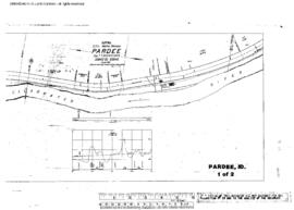
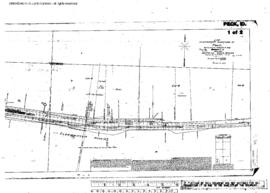
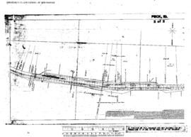
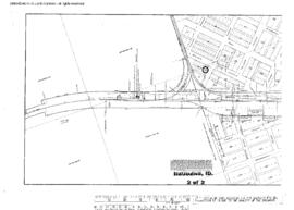
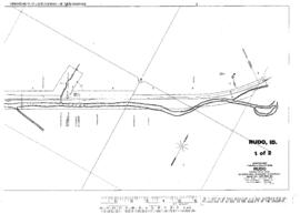
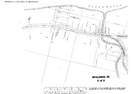
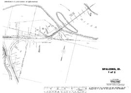
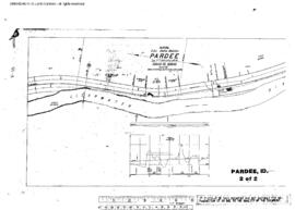
Plat Map of Canadian Pacific facilities at Pardee, Idaho, October 29, 1910, Sheet Number 2, Line Segment 461, showing the Orofino-Stites line.
Plat Map of Canadian Pacific facilities at Pardee, Idaho, October 29, 1910, Sheet Number 1, Line Segment 461, showing the Orofino-Stites line.
Plat Map of Canadian Pacific facilities at Peck, Idaho, March 14, 1908, Sheet Number 1, Line Segment 462, showing the Arrow-Headquarters line.
Plat Map of Canadian Pacific facilities at Peck, Idaho, March 14, 1908, Sheet Number 2, Line Segment 462, showing the Arrow-Headquarters line.
Plat Map of Canadian Pacific facilities at Reubens, Idaho, July 1, 1913, Sheet Number 1, Line Segment 460, showing the Spalding-Grangeville line.
Plat Map of Canadian Pacific facilities at Reubens, Idaho, July 1, 1913, Sheet Number 2, Line Segment 460, showing the Spalding-Grangeville line.
Plat Map of Canadian Pacific facilities at Rudo, Idaho, September 1, 1928, Sheet Number 2, Line Segment 462, showing the Arrow-Headquarters line.
Plat Map of Canadian Pacific facilities at Rudo, Idaho, September 1, 1928, Sheet Number 1, Line Segment 462, showing the Arrow-Headquarters line.
Plat Map of Canadian Pacific facilities at Spalding, Idaho, undated, Sheet Number 2, Line Segment 459, 460, showing the Arrow-Lewiston line, Spalding-Grangevilleÿline.
Plat Map of Canadian Pacific facilities at Spalding, Idaho, undated, Sheet Number 1, Line Segment 459, 460, showing the Arrow-Lewiston line, Spalding-Grangeville line.