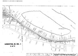
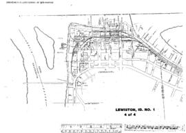
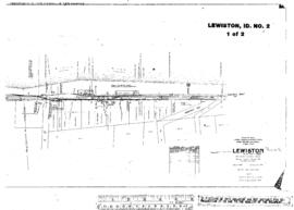
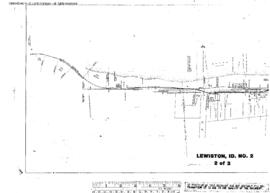
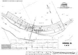
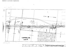
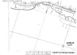
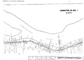
Plat Map of Canadian Pacific facilities at Lewiston, Idaho, undated, Sheet Number 2, Line Segment 696, showing the Lewiston yard.
Plat Map of Canadian Pacific facilities at Lewiston, Idaho, undated, Sheet Number 3, Line Segment 696, showing the Lewiston yard.
Plat Map of Canadian Pacific facilities at Lewiston, Idaho, undated, Sheet Number 4, Line Segment 696, showing the Lewiston yard, industry spurs.
Plat Map of Canadian Pacific facilities at Lewiston, Idaho, January 23, 1919, Sheet Number 1, Line Segment 696, showing the Lewiston yard.
Plat Map of Canadian Pacific facilities at Lewiston, Idaho, January 23, 1919, Sheet Number 2, Line Segment 696, showing the Lewiston yard.
Plat Map of Canadian Pacific facilities at Lenore, Idaho, June 10, 1909, Sheet Number 1, Line Segment 461, showing the Orofino-Stites line.
Plat Map of Canadian Pacific facilities at Lenore, Idaho, June 10, 1909, Sheet Number 2, Line Segment 461, showing the Orofino-Stites line.
Plat Map of Canadian Pacific facilities at Lapwai, Idaho, March 31, 1905, Sheet Number 2, Line Segment 460, showing the Spalding-Grangeville line.
Plat Map of Canadian Pacific facilities at Lapwai, Idaho, March 31, 1905, Sheet Number 1, Line Segment 460, showing the Spalding-Grangeville line.
Plat Map of Canadian Pacific facilities at Jaype, Idaho, September 1, 1928, Sheet Number 3, Line Segment 462, showing the Arrow-Headquarters line.