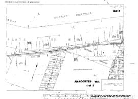
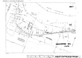
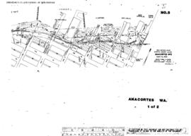
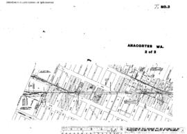
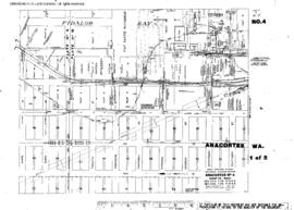
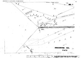
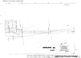
Plat Map of Great Northern facilities at Antelope, Montana, December 1, 1914, Sheet Number 1, Line Segment 355, showing the Bainville-Opheim line.
Plat Map of Great Northern facilities at Anacortes, Washington, undated, Sheet Number 1, Line Segment 413, showing the Anacortes-Shannon Point line.
Plat Map of Great Northern facilities at Anacortes, Washington, undated, Sheet Number 2, Line Segment 413, showing the Anacortes-Shannon Point line, Ship Harbor.
Plat Map of Great Northern facilities at Anacortes, Washington, October 1, 1967, Sheet Number 1, Line Segment 409, showing the Concrete-Anacortes line, downtown, industry spurs.
Plat Map of Great Northern facilities at Anacortes, Washington, May 1, 1967, Sheet Number 2, Line Segment 413, showing the Anacortes-Shannon Point line.
Plat Map of Great Northern facilities at Anacortes, Washington, May 1, 1967, Sheet Number 1, Line Segment 413, showing the Anacortes-Shannon Point line.
Plat Map of Great Northern facilities at Anacortes, Washington, October 1, 1967, Sheet Number 2, Line Segment 409, showing the Concrete-Anacortes line, downtown, industry spurs.
Plat Map of Great Northern facilities at Anacortes, Washington, November 1, 1963, Sheet Number 2, Line Segment 409, 413, showing the Concrete-Anacortes line, downtown yard, industry spurs; Anacortes-Shannon Point line.
Plat Map of Great Northern facilities at Anacortes, Washington, November 1, 1963, Sheet Number 1, Line Segment 409, showing the Concrete-Anacortes line, downtown, industry spurs.
Plat Map of Great Northern facilities at Anacortes, Washington, June 1, 1920, Sheet Number 2, Line Segment 409, showing the Concrete-Anacortes line, Fidalgo Waterway to Weaverling Spit (partial).