Plat Map of Great Northern facilities at Kershaw, Montana, undated, Sheet Number 1, Line Segment 353, showing the Pacific Junction-Great Falls line.
Plat Map of Great Northern facilities at Kershaw, Montana, undated, Sheet Number 2, Line Segment 353, showing the Pacific Junction-Great Falls line.
Plat Map of Great Northern facilities at Kettle Falls, Washington, July 1, 1941, Sheet Number 3, Line Segment 376, showing the Boundary-Dean-Kettle Falls line.
Plat Map of Great Northern facilities at Kettle Falls, Washington, July 1, 1941, Sheet Number 1, Line Segment 376, showing the Boundary-Dean-Kettle Falls line.
Plat Map of Great Northern facilities at Kettle Falls, Washington, July 1, 1941, Sheet Number 2, Line Segment 376, showing the Boundary-Dean-Kettle Falls line.
Plat Map of Great Northern facilities at Kevin, Montana, undated, Sheet Number 2, Line Segment 354, showing the Great Falls-Sweet Grass line.
Plat Map of Great Northern facilities at Kevin, Montana, undated, Sheet Number 1, Line Segment 354, showing the Great Falls-Sweet Grass line.
Plat Map of Great Northern facilities at Kingston, Montana, undated, Sheet Number 1, Line Segment 364, showing the Spring Creek Junction-Moccasin line.
Plat Map of Great Northern facilities at Kingston, Montana, undated, Sheet Number 2, Line Segment 364, showing the Spring Creek Junction-Moccasin line.
Plat Map of Great Northern facilities at Kingston, Montana, undated, Sheet Number 1, Line Segment 364, showing the Spring Creek Junction-Moccasin line.
Plat Map of Great Northern facilities at Kintyre, Montana, February 1, 1930, Sheet Number 1, Line Segment 35, showing the Minot-Pacific Junctionÿline.
Plat Map of Great Northern facilities at Kintyre, Montana, February 1, 1930, Sheet Number 2, Line Segment 35, showing the Minot-Pacific Junction line.
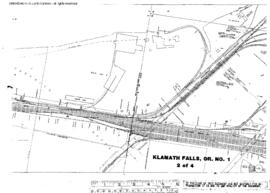
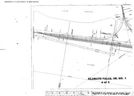
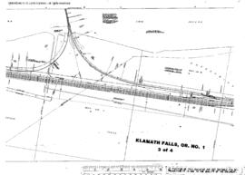
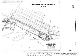
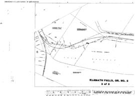
Plat Map of Great Northern facilities at Klamath Falls To Malin, Oregon, January 1, 1931, Sheet Number 1, Line Segment 639, showing the Klamath Falls area.
Plat Map of Great Northern facilities at Klamath Falls To Malin, Oregon, January 1, 1931, Sheet Number 2, Line Segment 55, showing the Klamath Falls-Keddie line.
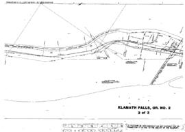
Plat Map of Great Northern facilities at Klamath Falls To Malin, Oregon, January 1, 1931, Sheet Number 3, Line Segment 55, showing the Klamath Falls-Keddie line.
Plat Map of Great Northern facilities at Klamath Falls, Oregon, August 1, 1930, Sheet Number 3, Line Segment 55, showing the Weyerhaeuser trackage.
Plat Map of Great Northern facilities at Klamath Falls, Oregon, June 1, 1930, Sheet Number 1, Line Segment 55, showing the Klamath Falls yard, fruit spur.
Plat Map of Great Northern facilities at Klamath Falls, Oregon, August 1, 1930, Sheet Number 2, Line Segment 55, showing the Weyerhaeuser trackage.
Plat Map of Great Northern facilities at Klamath Falls, Oregon, August 1, 1930, Sheet Number 4, Line Segment 55, showing the Weyerhaeuser trackage.
Plat Map of Great Northern facilities at Klamath Falls, Oregon, June 1, 1930, Sheet Number 2, Line Segment 55, showing the Industry spur.
Plat Map of Great Northern facilities at Klamath Falls, Oregon, August 1, 1930, Sheet Number 1, Line Segment 55, showing the Weyerhaeuser trackage.
Plat Map of Great Northern facilities at Klamath Falls, Oregon, June 1, 1962, Sheet Number 2, Line Segment 55, showing the Riverside spur.
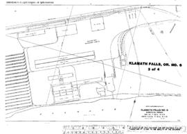
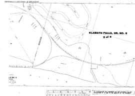
Plat Map of Great Northern facilities at Klamath Falls, Oregon, March 1, 1962, Sheet Number 2, Line Segment 55, showing the Klamath Falls yard, Southern Pacific interchange.
Plat Map of Great Northern facilities at Klamath Falls, Oregon, March 1, 1962, Sheet Number 4, Line Segment 55, showing the Klamath Falls yard, Southern Pacific interchange.
Plat Map of Great Northern facilities at Klamath Falls, Oregon, March 1, 1962, Sheet Number 1, Line Segment 55, showing the Klamath Falls yard, industry spurs.
Plat Map of Great Northern facilities at Klamath Falls, Oregon, March 1, 1962, Sheet Number 3, Line Segment 55, showing the Klamath Falls yard, Southern Pacific interchange.
Plat Map of Great Northern facilities at Klamath Falls, Oregon, June 1, 1962, Sheet Number 1, Line Segment 55, showing the Riverside spur.
Plat Map of Great Northern facilities at Klamath Falls, Oregon, June 1, 1962, Sheet Number 3, Line Segment 55, showing the Riverside spur.
Plat Map of Great Northern facilities at Klamath Falls, Oregon, April 14, 1965, Sheet Number 1, Line Segment 639, showing the South Klamath yard.