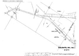
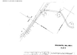
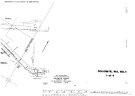
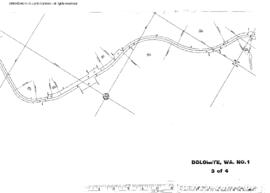
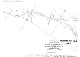
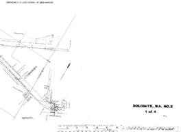
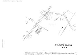
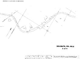
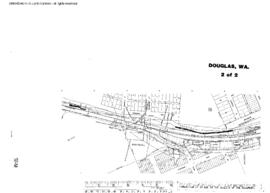
Plat Map of Great Northern facilities at Douglas, Washington, July 1, 1963, Sheet Number 2, Line Segment 386, showing the Mansfield-Columbia River line.
Plat Map of Great Northern facilities at Dolomite, Washington, September 1, 1969, Sheet Number 2, Line Segment 376, showing the Boundary-Dean-Kettle Falls line.
Plat Map of Great Northern facilities at Dolomite, Washington, September 1, 1969, Sheet Number 4, Line Segment 376, showing the Boundary-Dean-Kettle Falls line.
Plat Map of Great Northern facilities at Dolomite, Washington, September 1, 1969, Sheet Number 1, Line Segment 376, showing the Boundary-Dean-Kettle Falls line.
Plat Map of Great Northern facilities at Dolomite, Washington, September 1, 1969, Sheet Number 3, Line Segment 376, showing the Boundary-Dean-Kettle Falls line.
Plat Map of Great Northern facilities at Dolomite, Washington, January 27, 1943, Sheet Number 2, Line Segment 376, showing the Boundary-Dean-Kettle Falls line.
Plat Map of Great Northern facilities at Dolomite, Washington, January 27, 1943, Sheet Number 1, Line Segment 376, showing the Boundary-Dean-Kettle Falls line.
Plat Map of Great Northern facilities at Dolomite, Washington, January 27, 1943, Sheet Number 4, Line Segment 376, showing the Boundary-Dean-Kettle Falls line.
Plat Map of Great Northern facilities at Dolomite, Washington, January 27, 1943, Sheet Number 3, Line Segment 376, showing the Boundary-Dean-Kettle Falls line.
Plat Map of Great Northern facilities at Dodson, Montana, October 1, 1962, Drawing Number 01276, Sheet Number 4, Line Segment 35, showing the Minot-Pacific Junction line.