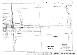
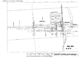
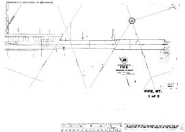
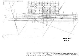
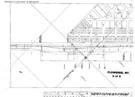
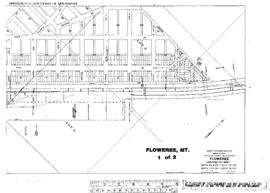
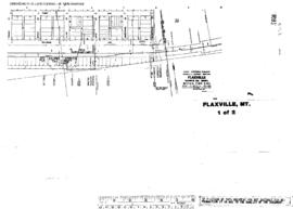
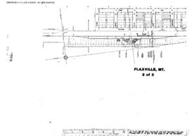
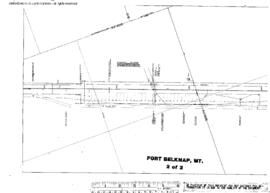
Plat Map of Great Northern facilities at Fort Belknap, Montana, October 1, 1960, Sheet Number 2, Line Segment 35, showing the Minot-Pacific Junction line.
Plat Map of Great Northern facilities at Floweree, Montana, December 1, 1913, Sheet Number 2, Line Segment 353, showing the Pacific Junction-Great Falls line.
Plat Map of Great Northern facilities at Floweree, Montana, December 1, 1913, Sheet Number 1, Line Segment 353, showing the Pacific Junction-Great Falls line.
Plat Map of Great Northern facilities at Flaxville, Montana, August 1, 1964, Sheet Number 1, Line Segment 355, showing the Bainville-Opheim line.
Plat Map of Great Northern facilities at Flaxville, Montana, August 1, 1964, Sheet Number 2, Line Segment 355, showing the Bainville-Opheim line.
Plat Map of Great Northern facilities at Fir, Washington, January 1, 1947, Sheet Number 1, Line Segment 50, showing the White Rock-Settle line.
Plat Map of Great Northern facilities at Fir, Washington, January 1, 1947, Sheet Number 2, Line Segment 50, showing the White Rock-Settle line.
Plat Map of Great Northern facilities at Fir, Washington, November 14, 1945, Sheet Number 1, Line Segment 50, showing the White Rock-Settle line, industry trackage.
Plat Map of Great Northern facilities at Fife, Montana, August 1, 1914, Sheet Number 1, Line Segment 362, showing the Mossmain-Great Falls line.
Plat Map of Great Northern facilities at Fife, Montana, August 1, 1914, Sheet Number 2, Line Segment 362, showing the Mossmain-Great Falls line.