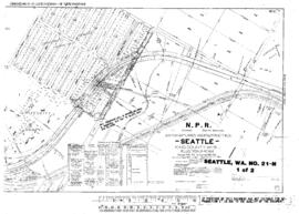
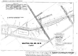
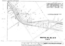
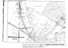
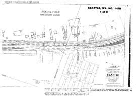
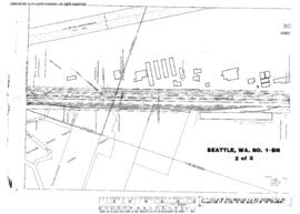
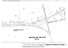
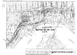
Plat Map of Northern Pacific facilities at Seattle, Washington, March 15, 1913, Sheet Number 3, showing the West Seattle, Harbor Avenue Southwest, north end.
Plat Map of Northern Pacific facilities at Seattle, Washington, October 15, 1914, Sheet Number 1, Line Segment 403, showing the Seattle-Sumas line, 39th Avenue Northeast-45th Avenue Northeast.
Plat Map of Northern Pacific facilities at Seattle, Washington, November 4, 1914, Sheet Number 1, Line Segment 403, showing the Seattle-Sumas line, Sand Point, Naval Station.
Plat Map of Northern Pacific facilities at Seattle, Washington, November 4, 1914, Sheet Number 2, Line Segment 403, showing the Seattle-Sumas line, Keith, Sand Point Way Northeast.
Plat Map of Northern Pacific facilities at Seattle, Washington, October 15, 1914, Sheet Number 2, Line Segment 403, showing the Seattle-Sumas line, 30th Avenue Northeast-39th Avenue Northeast.
Plat Map of Northern Pacific facilities at Seattle, Washington, October 21, 1915, Sheet Number 1, Line Segment 51, showing the Seattle-Tacoma line, Milwaukee Road Van Asselt, south end.
Plat Map of Northern Pacific facilities at Seattle, Washington, October 21, 1915, Sheet Number 2, Line Segment 51, showing the Seattle-Tacoma line, Airport Way, south end.
Plat Map of Northern Pacific facilities at Seattle, Washington, December 17, 1915, Sheet Number 1, Line Segment 403, showing the Seattle-Sumas line, University, 7th Avenue Northeast-University of Washington campus.
Plat Map of Northern Pacific facilities at Seattle, Washington, December 22, 1915, Sheet Number 2, Line Segment 403, showing the Seattle-Sumas line, University of Washington campus east side.
Plat Map of Northern Pacific facilities at Seattle, Washington, December 17, 1915, Sheet Number 2, Line Segment 403, showing the Seattle-Sumas line, Latona, Eastern Avenue North-11th Avenue Northeast.