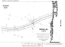
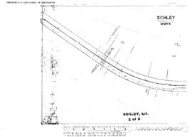
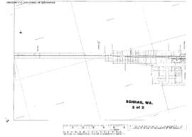
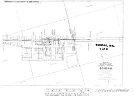
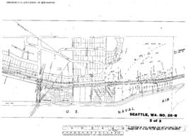
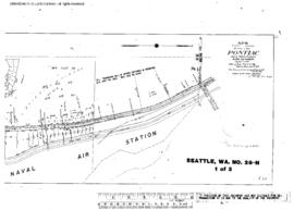
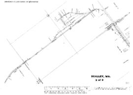
Plat Map of Northern Pacific facilities at Scalley, Washington, October 30, 1953, Sheet Number 2, Line Segment 379, showing the Odair-Connell line.
Plat Map of Northern Pacific facilities at Schley, Montana, July 8, 1916, Sheet Number 1, Line Segment 42, showing the Helena-Paradise line.
Plat Map of Northern Pacific facilities at Schley, Montana, July 8, 1916, Sheet Number 2, Line Segment 42, showing the Helena-Paradise line.
Plat Map of Northern Pacific facilities at Schrag, Washington, December 20, 1917, Sheet Number 2, Line Segment 449, showing the Schrag-Bassett Junction line.
Plat Map of Northern Pacific facilities at Schrag, Washington, December 20, 1917, Sheet Number 1, Line Segment 449, showing the Schrag-Bassett Junction line.
Plat Map of Northern Pacific facilities at Seattle, Washington, January 7, 1910, Sheet Number 2, Line Segment 403, showing the Seattle-Sumas line, Sand Point Naval Air Station.
Plat Map of Northern Pacific facilities at Seattle, Washington, January 7, 1910, Sheet Number 3, Line Segment 403, showing the Seattle-Sumas line, county road (Sand Point Way Northeast).
Plat Map of Northern Pacific facilities at Seattle, Washington, January 7, 1910, Sheet Number 1, Line Segment 403, showing the Seattle-Sumas line, Pontiac, Sand Point Naval Air Station.
Plat Map of Northern Pacific facilities at Seattle, Washington, March 15, 1913, Sheet Number 1, showing the West Seattle Yard, Harbor Avenue Southwest.
Plat Map of Northern Pacific facilities at Seattle, Washington, March 15, 1913, Sheet Number 2, showing the West Seattle, Harbor Avenue Southwest.