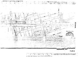
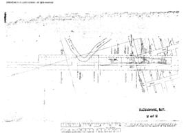
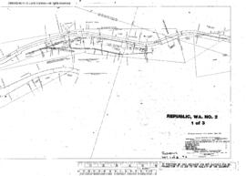
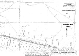
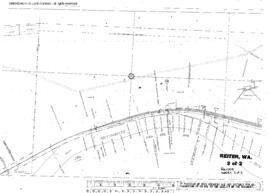
Plat Map of Great Northern facilities at Richland, Montana, January 1, 1927, Sheet Number 2, Line Segment 460, showing the Bainville-Opheim line.
Plat Map of Great Northern facilities at Reserve, Montana, January 1, 1964, Drawing Number 59038, Sheet Number 1, Line Segment 355, showing the Bainville-Opheim line.
Plat Map of Great Northern facilities at Reserve, Montana, January 1, 1964, Drawing Number 59038, Sheet Number 2, Line Segment 355, showing the Bainville-Opheim line.
Plat Map of Great Northern facilities at Republic, Washington, September 1, 1963, Sheet Number 1, Line Segment 377, showing the Kettle Falls-Republic line.
Plat Map of Great Northern facilities at Republic, Washington, September 1, 1963, Sheet Number 2, Line Segment 377, showing the Kettle Falls-Republic line.
Plat Map of Great Northern facilities at Republic, Washington, April 1, 1918, Sheet Number 3, Line Segment 377, showing the Kettle Falls-Republic line.
Plat Map of Great Northern facilities at Republic, Washington, April 1, 1918, Sheet Number 2, Line Segment 377, showing the Kettle Falls-Republic line.
Plat Map of Great Northern facilities at Republic, Washington, April 1, 1918, Sheet Number 1, Line Segment 377, showing the Kettle Falls-Republic line.
Plat Map of Great Northern facilities at Reiter, Washington, October 20, 1947, Sheet Number 1, Line Segment 37, showing the Sandpoint Junction-Everett Junction line.
Plat Map of Great Northern facilities at Reiter, Washington, October 20, 1947, Sheet Number 2, Line Segment 37, showing the Sandpoint Junction-Everett Junction line.