US WaBuPNRA D0027-004-012-002-Plat011510
·
Item
·
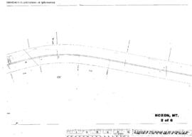
September 22, 1956
Part of Timothy Miller Collection
Plat Map of Northern Pacific facilities at Noxon, Montana, September 22, 1956, Sheet Number 5, Line Segment 44, showing the Paradise-Kootenai line.