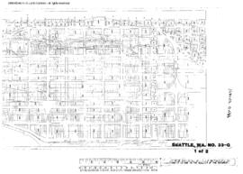
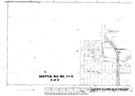
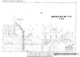
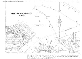
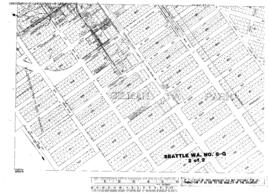
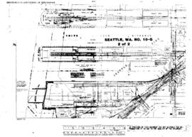
Plat Map of Great Northern facilities at Seattle, Washington, August 1, 1930, Drawing Number 8500-10, Sheet Number 2, Line Segment 619, showing the Smith Cove piers.
Plat Map of Great Northern facilities at Seattle, Washington, September 4, 1926, Sheet Number 2, Line Segment 619, showing the East Marginal Way-Airport Way, Lander Street-Yesler Way, switching leads only, mainlines not shown.
Plat Map of Great Northern facilities at Seattle, Washington, September 4, 1926, Sheet Number 1, Line Segment 619, showing the East Marginal Way-Airport Way, Spokane Street-South Atlantic Street, switching leads only, mainlines not shownÿ.
Plat Map of Great Northern facilities at Seattle, Washington, July 1, 1921, Sheet Number 2, Line Segment 619, showing the Interbay, Northern Pacific glass works spur.
Plat Map of Great Northern facilities at Seattle, Washington, July 1, 1921, Sheet Number 1, Line Segment 619, showing the Interbay, Northern Pacific glass works spur.
Plat Map of Great Northern facilities at Seattle, Washington, April 1, 1918, Sheet Number 1, Line Segment 619, showing the Ballard line.
Plat Map of Great Northern facilities at Seattle, Washington, November 1, 1918, Sheet Number 2, Line Segment 619, showing the East Marginal Way, partial.
Plat Map of Great Northern facilities at Seattle, Washington, November 1, 1918, Sheet Number 1, Line Segment 619, showing the East Marginal Way, industry and dock spurs.
Plat Map of Great Northern facilities at Seattle, Washington, April 1, 1918, Sheet Number 2, Line Segment 619, showing the Ballard line.
Plat Map of Great Northern facilities at Seattle, Washington, January 1, 1916, Sheet Number 2, Line Segment 619, showing the Waterfront, Stacy Street Yard (north end), dock spurs.