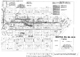
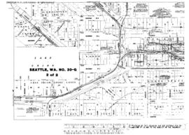
US WaBuPNRA D0027-003-012-002-Plat013853
·
Item
·
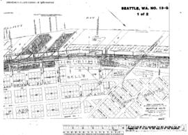
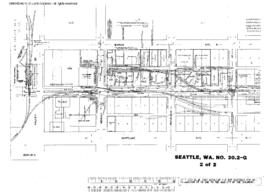
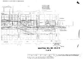
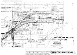
September 1, 1938
Part of Timothy Miller Collection
Plat Map of Great Northern facilities at Seattle, Washington, September 1, 1938, Sheet Number 3, Line Segment 619, showing the Lake Union line, Westlake Avenue-Fremont Bridge.