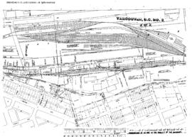
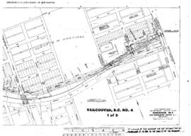
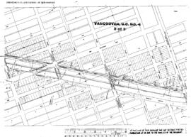
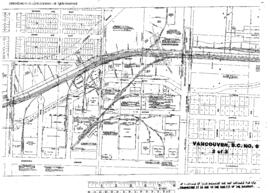
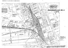
Plat Map of Great Northern facilities at Vancouver, British Columbia, undated, Sheet Number 1, Line Segment 600, showing the Vancouver Junction, Canadian National yard.
Plat Map of Great Northern facilities at Vancouver, British Columbia, August 1, 1960, Sheet Number 2, Line Segment 600, showing the Glen Drive Yard, Canadian National False Creek Yard.
Plat Map of Great Northern facilities at Vancouver, British Columbia, August 1, 1960, Sheet Number 1, Line Segment 600, showing the Hastings, Renfrew Street-Nanaimo Street.
Plat Map of Great Northern facilities at Vancouver, British Columbia, August 1, 1960, Sheet Number 3, Line Segment 600, showing the False Creek, Main Street-Cook Street, Canadian National freight house.
Plat Map of Great Northern facilities at Vancouver, British Columbia, August 1, 1960, Sheet Number 1, Line Segment 600, showing the Glen Drive yards.
Plat Map of Great Northern facilities at Vancouver, British Columbia, August 1, 1960, Sheet Number 2, Line Segment 600, showing the Hastings, Nanaimo Street-Commercial Street.
Plat Map of Great Northern facilities at Vancouver, British Columbia, August 1, 1960, Sheet Number 3, Line Segment 600, showing the Hastings, Victoria Street-McClean Dr.
Plat Map of Great Northern facilities at Vancouver, British Columbia, March 1, 1954, Sheet Number 2, Line Segment 600, showing the Cornett Road-Rupert Street, industry spurs.
Plat Map of Great Northern facilities at Vancouver, British Columbia, June 1, 1954, Sheet Number 1, Line Segment 600, showing the Renfrew Street-Gilmore Avenue.
Plat Map of Great Northern facilities at Vancouver, British Columbia, June 1, 1954, Sheet Number 2, Line Segment 600, showing the Boundary Road-Rupert Street, industry spurs.