Plat Map of Great Northern facilities at Cawston, British Columbia, August 1, 1920, Sheet Number 1, Line Segment 393, showing the Chopaka-Oroville (Curlew-Keremeos) line.
Plat Map of Great Northern facilities at Chelan Falls, Washington, May 1, 1945, Sheet Number 2, Line Segment 387, showing the Oroville-Wenatchee line.
Plat Map of Great Northern facilities at Chelan Falls, Washington, May 1, 1945, Sheet Number 1, Line Segment 387, showing the Oroville-Wenatchee line.
Plat Map of Great Northern facilities at Chelan, Washington, September 1, 1967, Sheet Number 1, Line Segment 387, showing the Oroville-Wenatchee line.
Plat Map of Great Northern facilities at Chelan, Washington, September 1, 1967, Sheet Number 2, Line Segment 387, showing the Oroville-Wenatchee line.
Plat Map of Great Northern facilities at Chelan, Washington, September 1, 1967, Sheet Number 3, Line Segment 387, showing the Oroville-Wenatchee line.
Plat Map of Great Northern facilities at Chelsea, Montana, December 1, 1919, Sheet Number 2, Line Segment 35, showing the Minot-Pacific Junction line.
Plat Map of Great Northern facilities at Chelsea, Montana, December 1, 1919, Sheet Number 1, Line Segment 35, showing the Minot-Pacific Junction line.
Plat Map of Great Northern facilities at Chemult, Oregon, June 1, 1941, Sheet Number 2, Line Segment 54, showing the Bend-Chemult line, wye.
Plat Map of Great Northern facilities at Chemult, Oregon, June 1, 1941, Sheet Number 1, Line Segment 54, showing the Bend-Chemult line.
Plat Map of Great Northern facilities at Chemult, Oregon, June 1, 1941, Sheet Number 3, Line Segment 54, showing the Bend-Chemult line, junction with Southern Pacific.
Plat Map of Great Northern facilities at Chemult, Oregon, June 1, 1941, Sheet Number 4, Line Segment 54, showing the Bend-Chemult line.
Plat Map of Great Northern facilities at Cheney, Washington, April 19, 1919, Sheet Number 3, Line Segment 378, showing the Cheney-Coulee City line.
Plat Map of Great Northern facilities at Chester, Montana, October 1, 1969, Sheet Number 1, Line Segment 36, showing the Pacific Junction-Sandpoint Junction line.
Plat Map of Great Northern facilities at Chester, Montana, October 1, 1969, Sheet Number 3, Line Segment 36, showing the Pacific Junction-Sandpoint Junction line.
Plat Map of Great Northern facilities at Chester, Montana, October 1, 1969, Sheet Number 4, Line Segment 36, showing the Pacific Junction-Sandpoint Junction line.
Plat Map of Great Northern facilities at Chester, Montana, October 1, 1969, Sheet Number 2, Line Segment 36, showing the Pacific Junction-Sandpoint Junction line.
Plat Map of Great Northern facilities at Chester, Montana, undated, Sheet Number 2, Line Segment 36, showing the Pacific Junction-Sandpoint Junction line.
Plat Map of Great Northern facilities at Chester, Montana, undated, Sheet Number 1, Line Segment 36, showing the Pacific Junction-Sandpoint Junction line.
Plat Map of Great Northern facilities at Chewelah, Washington, July 1, 1928, Sheet Number 2, Line Segment 376, showing the Boundary-Dean-Kettle Falls line.
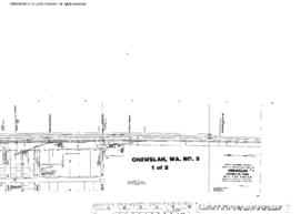
Plat Map of Great Northern facilities at Chewelah, Washington, July 1, 1928, Sheet Number 1, Line Segment 376, showing the Boundary-Dean-Kettle Falls line.
Plat Map of Great Northern facilities at Chewelah, Washington, October 1, 1963, Sheet Number 1, Line Segment 376, showing the Boundary-Dean-Kettle Falls line.
Plat Map of Great Northern facilities at Chewelah, Washington, October 1, 1963, Sheet Number 2, Line Segment 376, showing the Boundary-Dean-Kettle Falls line.
Plat Map of Great Northern facilities at Chewelah, Washington, undated, Sheet Number 1, Line Segment 376, showing the Boundary-Dean-Kettle Falls line.
Plat Map of Great Northern facilities at Chewelah, Washington, undated, Sheet Number 2, Line Segment 376, showing the Boundary-Dean-Kettle Falls line.
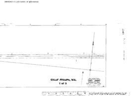
Plat Map of Great Northern facilities at Chief Joseph, Washington, September 1, 1953, Sheet Number 1, Line Segment 387, showing the Oroville-Wenatchee line.
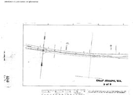
Plat Map of Great Northern facilities at Chief Joseph, Washington, September 1, 1953, Sheet Number 3, Line Segment 387, showing the Oroville-Wenatchee line.
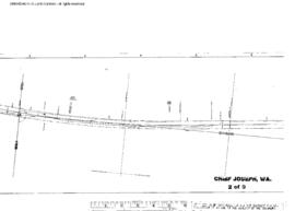
Plat Map of Great Northern facilities at Chief Joseph, Washington, September 1, 1953, Sheet Number 2, Line Segment 387, showing the Oroville-Wenatchee line.
Plat Map of Great Northern facilities at Chillowist, Washington, July 1, 1914, Drawing Number 8279-1, Sheet Number 1, Line Segment 387, showing the Oroville-Wenatchee line.
Plat Map of Great Northern facilities at Chillowist, Washington, July 1, 1914, Drawing Number 8279-1, Sheet Number 2, Line Segment 387, showing the Oroville-Wenatchee line.