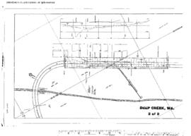
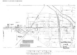
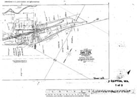
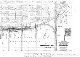
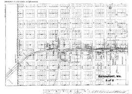
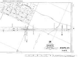
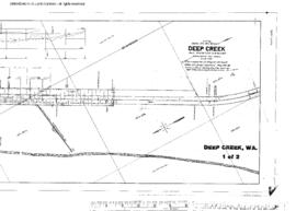
Plat Map of Northern Pacific facilities at Deep Creek, Washington, May 19, 1911, Sheet Number 1, Line Segment 378, showing the Cheney-Coulee City line.
Plat Map of Northern Pacific facilities at Deep Creek, Washington, May 19, 1911, Sheet Number 2, Line Segment 378, showing the Cheney-Coulee City line.
Plat Map of Northern Pacific facilities at De Smet, Montana, March 20, 1917, Drawing Number 31205, Sheet Number 2, Line Segment 43, showing the De Smet-Paradise line.
Plat Map of Northern Pacific facilities at De Smet, Montana, March 20, 1917, Drawing Number 31205, Sheet Number 1, Line Segment 43, showing the De Smet-Paradise line.
Plat Map of Northern Pacific facilities at Dayton, Washington, undated, Sheet Number 2, Line Segment 450, showing the Ainsworth Junction-Dayton line.
Plat Map of Northern Pacific facilities at Dayton, Washington, undated, Sheet Number 3, Line Segment 450, showing the Ainsworth Junction-Dayton line.
Plat Map of Northern Pacific facilities at Dayton, Washington, March 30, 1909, Sheet Number 1, Line Segment 450, showing the Ainsworth Junction-Dayton line.
Plat Map of Northern Pacific facilities at Davenport, Washington, March 1, 1921, Sheet Number 1, Line Segment 378, showing the Cheney-Coulee City line.
Plat Map of Northern Pacific facilities at Davenport, Washington, March 1, 1921, Sheet Number 2, Line Segment 378, showing the Cheney-Coulee City line.
Plat Map of Northern Pacific facilities at D'Aste, Montana, July 30, 1924, Sheet Number 1, Line Segment 334, showing the Dixon-Polson line.