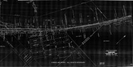
Great Northern Plat Map, Alstown, Washington. Milepost 30-34, Great Northern Washington Volume 5 Map 08, undated.
Great Northern Plat Map, Alcoa Spur, Washington. Milepost, Great Northern Washington Volume 3 Map 17c, undated.
Great Northern Plat Map, Adrian, Washington. Milepost 1586-1589, Great Northern Washington Volume 3 Map 03, undated.
Great Northern plat map E80 for Edmonds, Washington north ("railroad east") end including the depot area, circa 1944.
Great Northern Blueprint Number 1206-27, map of Crossing of Puget Sound & Baker River Railroad and Great Northern, 1907. Other subject categories: Plat
Great Northern Plat Map, Spokane, Washington. Milepost Property Acquistion, Great Northern Washington Volume 2 Map 01, 1972.
Great Northern Blueprint Number 1216-36-7, map of additional Land for Wolf Point Reservoir (2 copies and blueprint), 1925. Other subject categories: Filing Map
Great Northern Blueprint Number 1216-37-1, map of Wolf Point Pipe Line, 1918. Other subject categories: Filing Map
Great Northern Blueprint Number 1216-36-6, map of Wolf Point Reservoir, 1916. Other subject categories: Filing Map
Great Northern Blueprint Number 1216-36-6, map of Wolf Point Reservoir (2 copies), 1916. Other subject categories: Filing Map
Great Northern Blueprint Number 1216-33-4, map of Wolf Point Reservoir (2 copies and Blue Print), 1916. Other subject categories: Filing Map
Great Northern Blueprint Number 1241-4-1, map of Industrial Lead and Winnipeg Oil Spur, 1914. Other subject categories: Filing Map
Great Northern Blueprint Number 1624-9-2, map of additional Land at Station Grounds Wicks, 1954. Other subject categories: Filing Map
Great Northern Blueprint Number 1624-9-3, map of additional Land at Station Grounds Wicks, 1954. Other subject categories: Filing Map
Great Northern Blueprint Number 1004-44-1, map of Constructed Line, from Wenatchee through the Colville Indian Reservation, 1918. Other subject categories: Filing Map
Great Northern Blueprint Number 1045-1-4, map of Amended Survey and Location near Wagreat Northernersburg, 1962. Other subject categories: Filing Map
Great Northern Blueprint Number 1216-24-9, map of Tionesta, 1937. Other subject categories: Filing Map
Great Northern Blueprint Number 1619-2-3, map of Station Grounds Tiber, 1914. Other subject categories: Filing Map
Great Northern Blueprint Number 1619-2-2, map of Station Grounds Tiber, 1914. Other subject categories: Filing Map
Great Northern Blueprint Number 1619-2-1, map of Station Grounds Tiber, 1914. Other subject categories: Filing Map
Great Northern Blueprint Number 1624-9-4, map of Amended Survey and Location 2 Miles North of Sweet Grass Junction, 1960. Other subject categories: Filing Map
Great Northern Blueprint Number 1244-7-3, map of Station Ground Sweet Grass, 1926. Other subject categories: Filing Map
Great Northern Blueprint Number 1260-6-3, map of Spotted Robe Amended Location, undated. Other subject categories: Filing Map
Great Northern Blueprint Number 1260-6-4, map of Spotted Robe, 1955. Other subject categories: Filing Map
Great Northern Blueprint Number 1333-11-4, map of Station Grounds Scenic, 1928. Other subject categories: Filing Map
Great Northern Blueprint Number 1524-9-1, map of Water Station at Plentywood, 1914. Other subject categories: Filing Map
Great Northern Blueprint Number 1185-1-6, map of Kipp Revision, 1923. Other subject categories: Filing Map
Great Northern Blueprint Number 1249-9-5, map of Station Grounds Fort Shaw, undated. Other subject categories: Filing Map