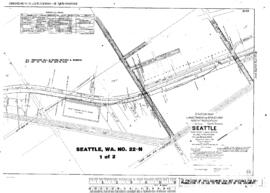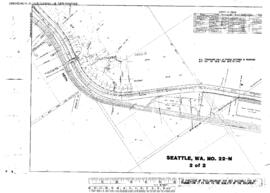
US WaBuPNRA D0027-004-012-002-Plat013870
·
Item
·
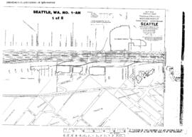
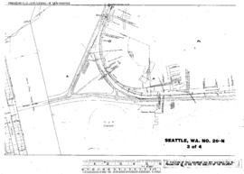
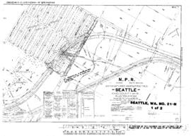
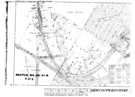
October 1, 1915
Part of Timothy Miller Collection
Plat Map of Northern Pacific facilities at Seattle, Washington, October 1, 1915, Sheet Number 2, Line Segment 51, showing the Seattle-Tacoma line, Milwaukee Road Van Asselt Yard.