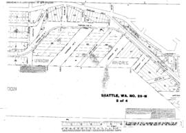
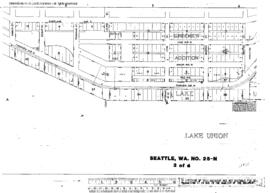
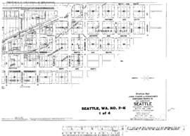
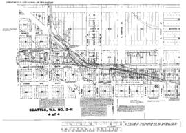
Plat Map of Northern Pacific facilities at Seattle, Washington, June 24, 1931, Sheet Number 1, showing the Harbor Island, north end, 11th Avenue Southwest, industry spurs.
Plat Map of Northern Pacific facilities at Seattle, Washington, June 24, 1931, Sheet Number 2, showing the Harbor Island, 11th Avenue Southwest, industry spurs.
Plat Map of Northern Pacific facilities at Seattle, Washington, January 11, 1922, Sheet Number 2, showing the Lake Union line, Southlake (Fairview) Avenue North, end of track.
Plat Map of Northern Pacific facilities at Seattle, Washington, January 11, 1922, Sheet Number 4, showing the Lake Union line, Fairview Avenue North, plat map only.
Plat Map of Northern Pacific facilities at Seattle, Washington, January 11, 1922, Sheet Number 1, showing the Lake Union line, Southlake (Fairview) Avenue North, Valley Street-end of track.
Plat Map of Northern Pacific facilities at Seattle, Washington, January 11, 1922, Sheet Number 3, showing the Lake Union line, Fairview Avenue North, plat map only.
Plat Map of Northern Pacific facilities at Seattle, Washington, September 1, 1919, Sheet Number 1, Line Segment 430, showing the Seattle-Argo line, Shore line, Airport Way, South Lyons Street-South Adams Street.
Plat Map of Northern Pacific facilities at Seattle, Washington, April 1, 1919, Sheet Number 1, Line Segment 430, showing the Seattle-Argo line, Shore line, north end.
Plat Map of Northern Pacific facilities at Seattle, Washington, April 1, 1919, Sheet Number 3, Line Segment 430, showing the Seattle-Argo line, Shore line, packing co spur, 7th Avenue South.
Plat Map of Northern Pacific facilities at Seattle, Washington, April 1, 1919, Sheet Number 4, Line Segment 430, showing the Seattle-Argo line, Shore line, Spokane Street.